


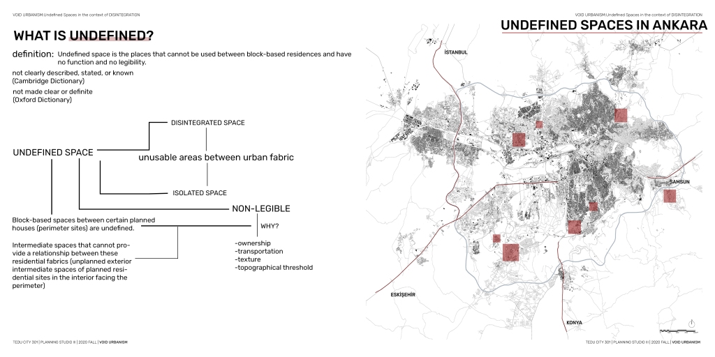

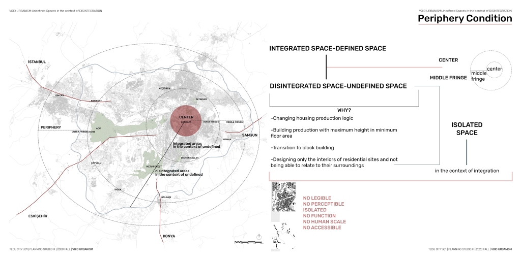


First of all, to remind my problem, how can I resolve these disintegrated areas that are different from each other is my main problem. In this context, I evaluated the concept of undefined space created by disintegration. I determined that the undefined space is the areas in different disintegrated urban fabrics. The problem of disintegration of undefined spacers arose as they came from the center towards the periphery.
I noticed an increase in undefined spaces due to disintegration as I moved from the center to the periphery of my work area. This emphasized the disconnections between different character areas.
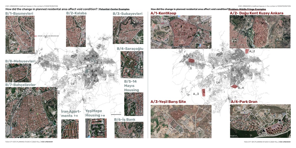
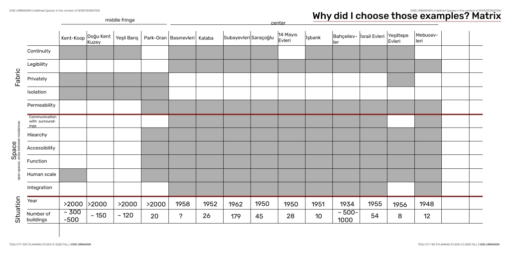
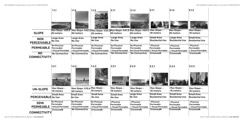
In order to compare how the problem of undefined spaces due to disintegration has changed, I determined the sub character fields that will reference my space.
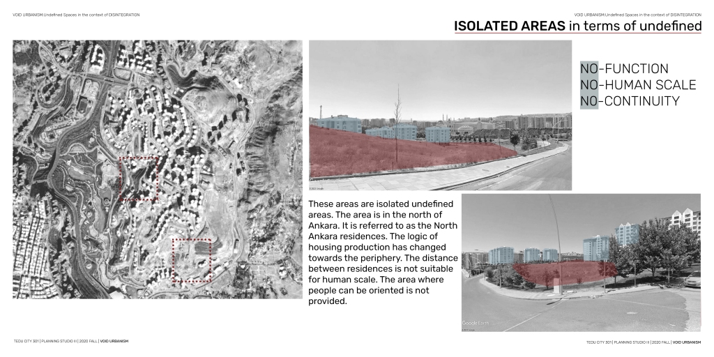
Although the ones in the center remained between different tissues, defined areas were defined by providing integration. But the more we came towards the periphery, the more undefined.
These fields created fields isolated from other fabrics in the undefined context.
some were teaching an integrated system in a context different from other tissues around them.
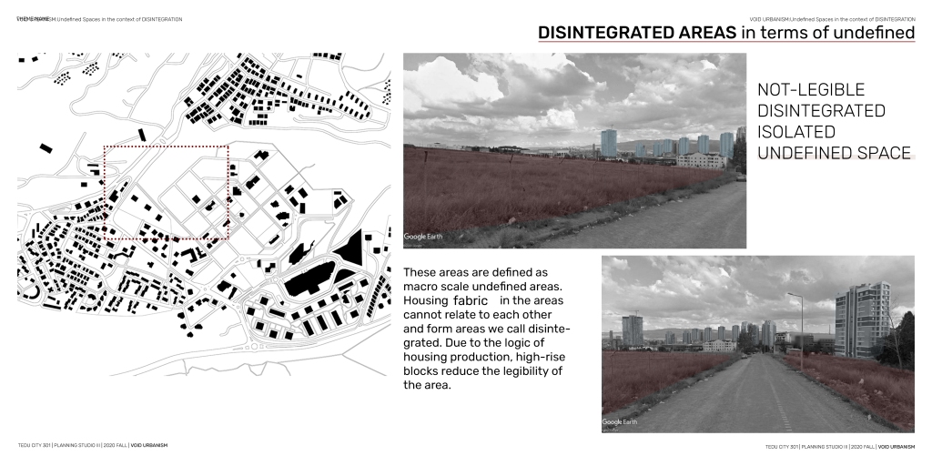
my study area was creating a disintegration problem in the context of undefined. 4 Sub character fields could not relate to each other.
When I determined the relationship of these areas with each other in a certain matrix order, I found that the urban fabric logic on the wall was lacking from these concepts.
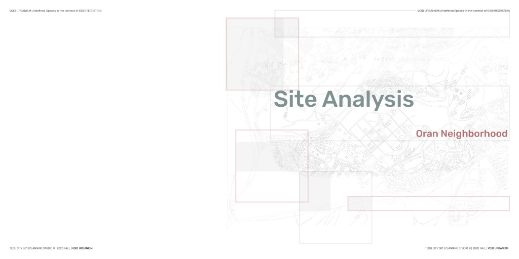
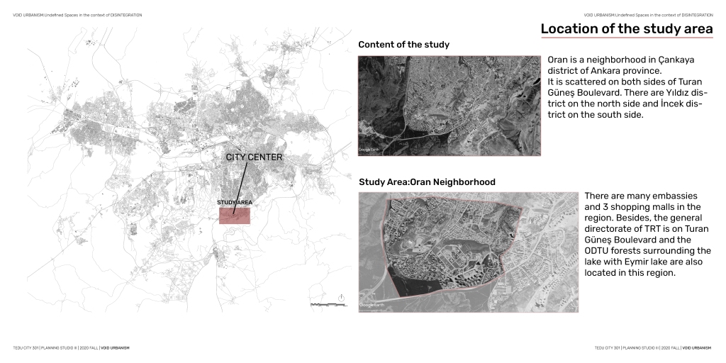
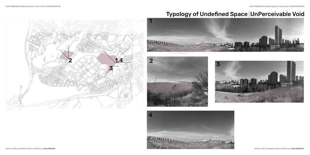
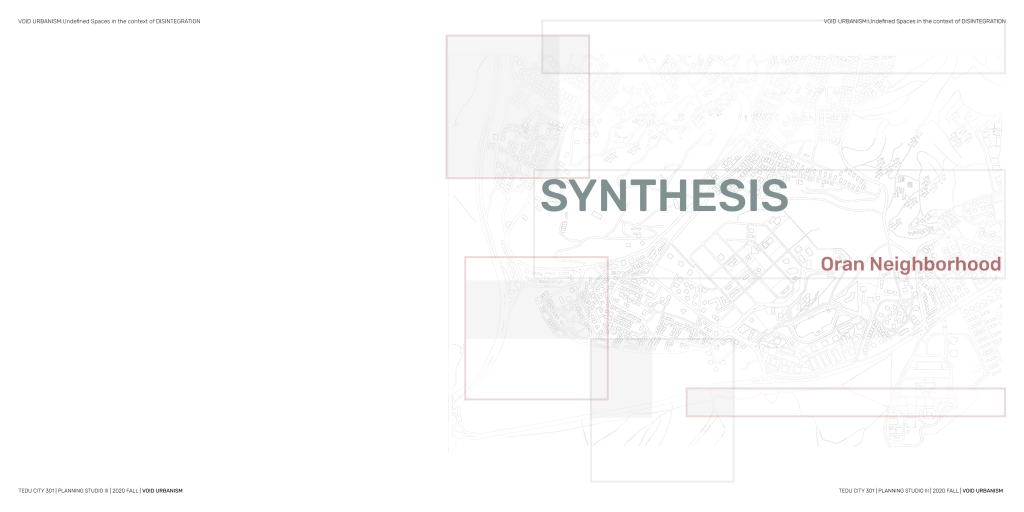
In my field, this is one of the examples on the periphery. Oran Neighborhood.
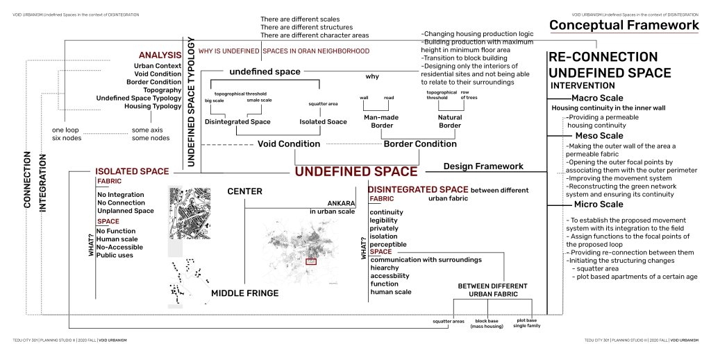
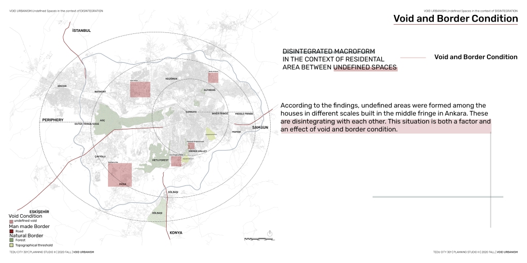
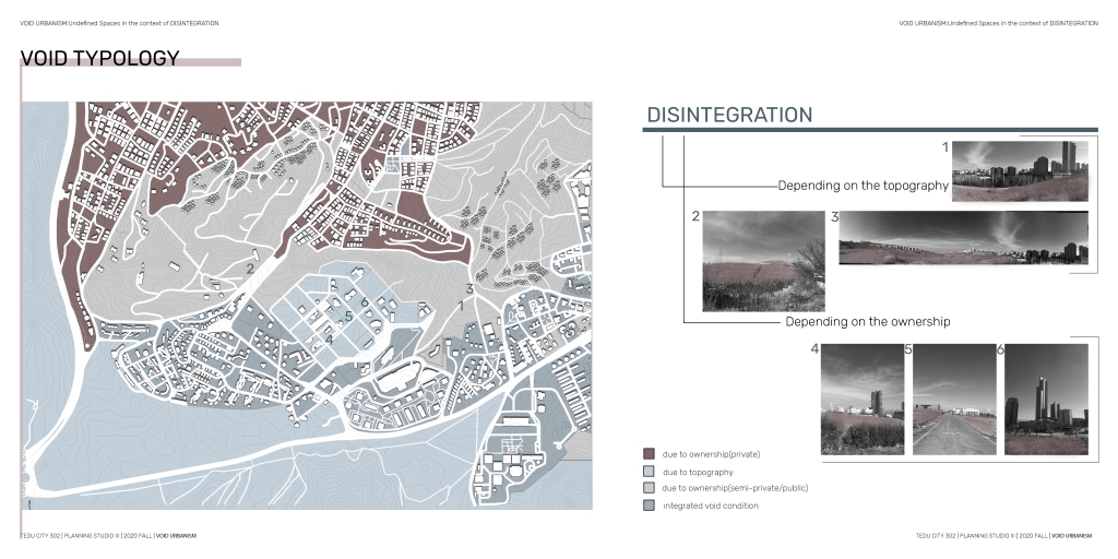
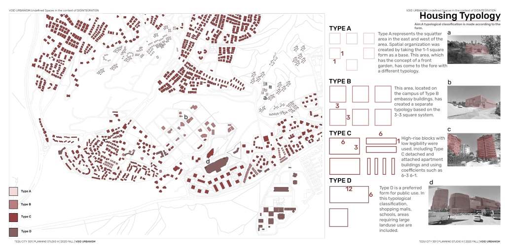
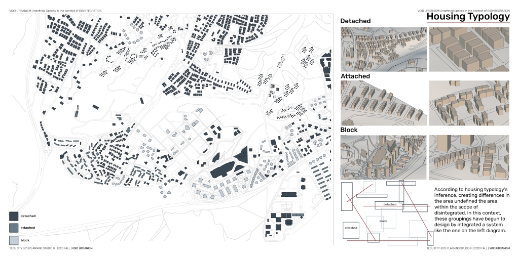
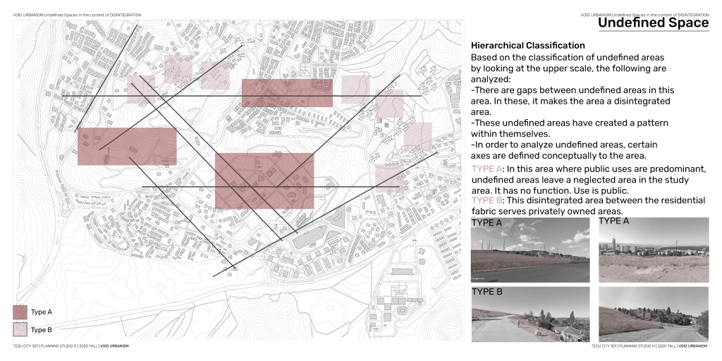
my problem definition is to resolve the undefined spaces created by these different 4 character spaces, which are usually the residential area, in the context of disintegration I developed a void typology bookmark because it also refers to design during this period. This area, which has 4 different types of void typology, was separated from each other by edges.
these edges spatially defined the border condition, sometimes the wall, sometimes the tree series.
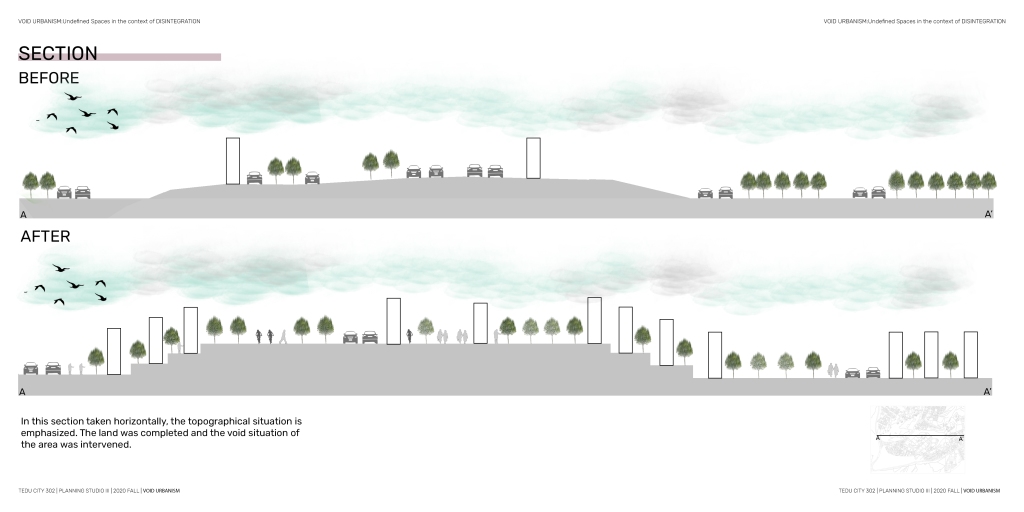
The reason is topography While disintegration was being formed, different building typologies occurred, these were classified as 4 typologies. These fields gave us these axes in the context of disintegration
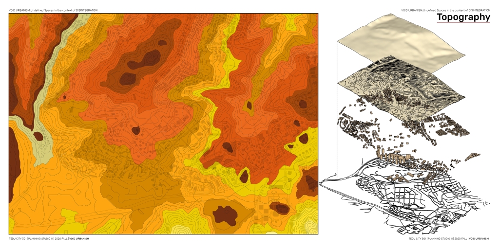
For this, I determined the lines of power and construction boundaries that follow each other so as to remain at the same elevation by using the topography.
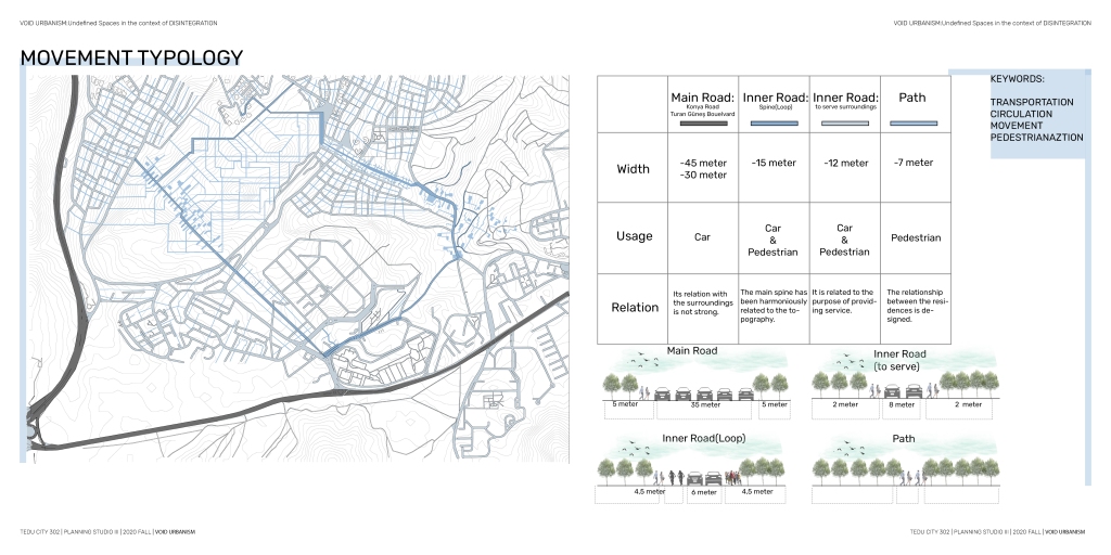
When I overlay it with the analysis in the field with topo, I got such references layer by layer. I aimed to define new solutions for the areas by defining the first circulation with the loop that breaks together.
Conceptual: I have developed 4 basic strategies in my conceptual diagram in their reference.
Connecting 4 different alt character fields
Identifying power lines in accordance with the topography
Determining the structuring limit and filling the void according to this limit
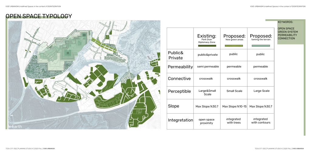
Integration with green areas provided by taming terrain
I thought about how the different sub-character areas will transform in their internal context, in the long and short term, and how they can relate to each other.
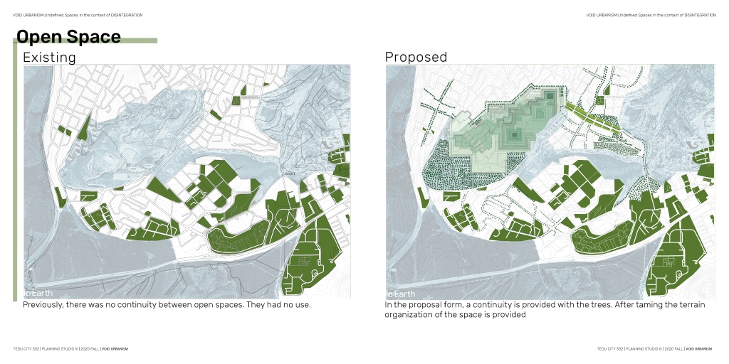
While connecting with a schematic loop, I determined the necessity of a different open area arrangement by transforming these areas.
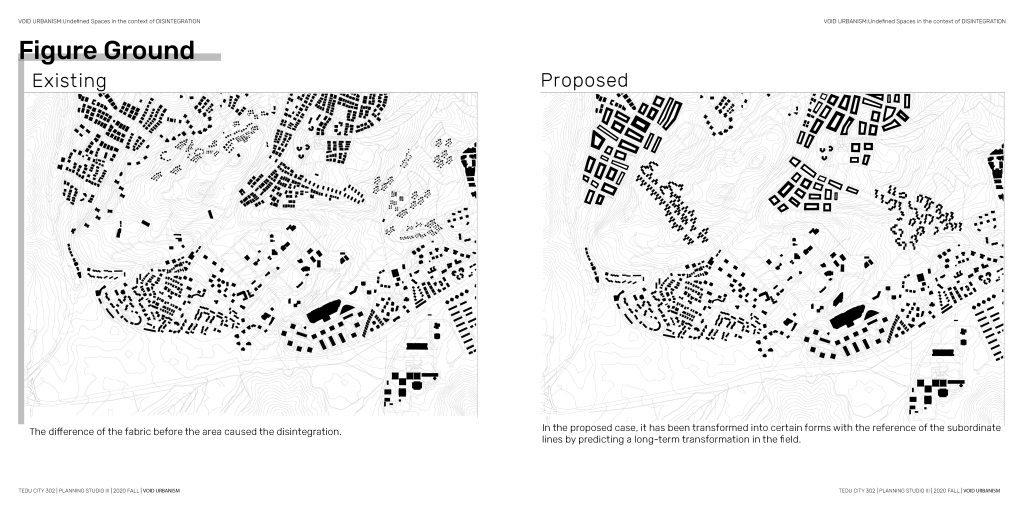
Master Plan:In this context, in the master plan I produced, I first focused on morphology, I developed a filling the void strategy with the question of whether a long-term transformation can occur in the slum areas that were formed in the area and are currently in ruins, while these fabrics are settled in harmony with the topography and a culture in a context that will integrate other areas. constitutes an art space. It is useful to define the loop. Then, in the long run, I formulated a strategy to ask what would happen if there was a transformation in the north of the area. I aimed to create more qualified and more legible spaces in the courtyard buildings I produced by preserving the existing traces of the area. With the lines coming from the topography, I spatialized the loop and determined its width as 15 meters and open to pedestrian vehicles. Loop connects different sub character fields to each other as a system. In order to transform the loop into a legible system, a green area was arranged in the north, while an open area continuity was made, areas where pedestrians could move were presented in the western part of the area thanks to taming the terrain intervention, and the paths that would connect the character areas were read by overcoming the topography. Locations and continuities have been added to different areas by giving directions with trees.

